The Douro map of the Baron of Forrester
There is a map behind the bottle. It is not a metaphor: the design of Palato do Côa directly references one of the first rigorous portraits of the Douro.
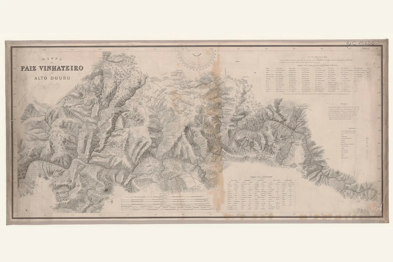
The Scottish Baron Joseph James Forrester carried out the topographical and geological survey of the Douro in the mid-19th century — the National Library of Portugal catalogues the work as [1843]. It was the first detailed map of the region — a precise portrait of the river, the slopes and the estates at a time when the Douro was still, in large part, territory yet to be fixed.
A map on the bottle
It is that historic map that the design of Palato do Côa evokes: the name “MAPA” and the green “zero” point on the bottle directly reference Forrester’s survey. A way of saying, without words, that the wine begins from an exact place — and that this place has a long history.
Origin and exact place
A map is, at heart, a statement of origin: here, and nowhere else. That is the spirit of the house editions that speak most of terroir, such as Vinha da Migalha — old vines over fifty years, the purest expression of the place the map came to fix.
Forrester’s map detailed the eastern frontier of the Douro Superior as far as where the Côa river flows into the Douro — a valley that holds a secret far older than any vineyard.
- O levantamento cartográfico do Douro pelo Barão de Forrester — obra com data atribuída de 1843 no catálogo da BNP — e a sua referência no design da garrafa do Palato do Côa.
From the Douro Superior to your table.
Explore the Palato do Côa collections or talk to the team for tech sheets and availability.